
Table of contents
- When is the golden rice season in Cao Bang?
- Cao Bang golden rice spots at a glance
- Ban Gioc Waterfall and Thoong Got: gold beside the falls
- Phong Nam and Ngoc Con: the upper Quay Son valley
- Hoai Khao and Lung Muoi: terraces in the west
- Phia Thap: harvest beside an incense village
- How to plan a golden rice trip in Cao Bang
- FAQ
When is the golden rice season in Cao Bang?
The rice turns gold about mid-September to early October, and each valley holds its colour for roughly a month before the harvest. Fields ripen at their own pace, even side by side, so think of the season as a window rather than a date, and ask your host how the nearby fields are looking before you set out.
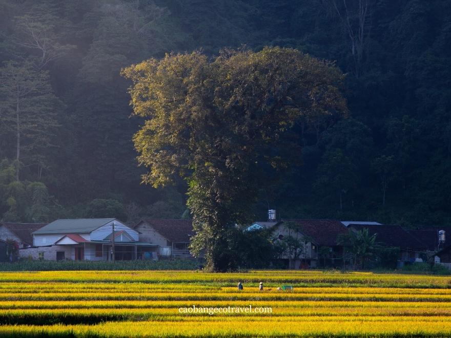
Keep an eye on the harvest, too. On the flat valley floors, combine harvesters can clear a field within days of it ripening, while steep, remote terraces are still cut by hand and change more slowly. The fields around Ban Gioc can also lag a little behind others in the area, which is worth knowing if the waterfall is your main stop.
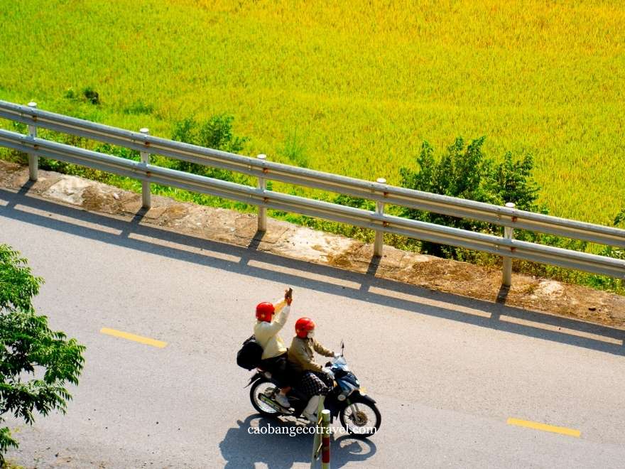
September is the tail end of the rainy season, and October is drier but a little less sunny. Valley mornings often start with mist on the peaks, and the hill villages of Nguyen Binh are noticeably cooler than Cao Bang city. For what the rest of the year looks like, month by month, see our guide to the best time to visit Cao Bang.
Cao Bang golden rice spots at a glance
Five of the seven spots lie east of Cao Bang city, on or near the Quay Son River, and can be linked in one long day. Hoai Khao and Lung Muoi lie west in Nguyen Binh and deserve a day of their own. Distances are approximate, so check your map app before setting off.
| Spot | Commune now (former) | Cao Bang city | Scenery |
|---|---|---|---|
| East: Quay Son River and National Road 3 | |||
| Phia Thap | Quang Uyen (Phuc Sen) | About 26 km | Small valley fields beside an incense village |
| Ban Gioc Waterfall | Dam Thuy (Dam Thuy) | About 85 km, 2 hours | Riverside paddies below the falls |
| Thoong Got | Dam Thuy (Chi Vien) | About 60 km to Trung Khanh, then the Chi Vien road | Smaller cascades, terraces at nearby Ban Ruoc |
| Phong Nam Valley | Dinh Phong (Phong Nam) | 65 to 70 km, 1.5 to 2 hours | Flat paddies inside a river bend |
| Ngoc Con | Dinh Phong (Ngoc Con) | Beyond Phong Nam on the same valley road | Riverside sticky rice fields near the border |
| West: Nguyen Binh | |||
| Lung Muoi | Thanh Cong (Quang Thanh) | About 45 km | Terraces in a small stream valley |
| Hoai Khao | Thanh Cong (Quang Thanh) | About 50 km | Terraces around a Dao Tien village |
If this is your first trip to the province, our Cao Bang travel guide shows how these areas fit together with the rest of the loop.
Ban Gioc Waterfall and Thoong Got: gold beside the falls
Ban Gioc Waterfall (Thác Bản Giốc)
Ban Gioc is where most golden-season journeys begin. Below the falls, rice fields run along the Quay Son right to the riverbank, and in September the water still pours over the limestone tiers in full force after the summer rains, so you get the harvest and the waterfall in a single view. For the widest angle, climb the hill to Truc Lam Ban Gioc Pagoda and look down over both.
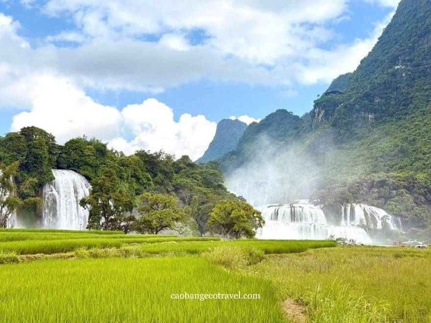
Because the paddies here can turn a little later than elsewhere, aim for the second half of the window if Ban Gioc is your main stop. The trip Hanoi is covered in our Ban Gioc logistics guide, and our Ban Gioc guide takes you out on the river towards the falls.
Thoong Got, ''Little Ban Gioc''
Upriver Ban Gioc, the Quay Son drops over a smaller set of cascades at Thoong Got, in Po Tau hamlet (formerly Chi Vien commune, now Dam Thuy). Locals call it Little Ban Gioc, and the Geopark lists the landscape among its heritage sites. The name describes the place: in the local language, thoong means waterfall and got the end point.
There are no boats here, so Thoong Got is a place to pause by the river rather than a full excursion. For more rice, follow the concrete road about a kilometre past the small hydropower plant to Ban Ruoc, a Tay hamlet beside Co La Waterfall, where little terraces turn gold around the same time as the valley below.
Phong Nam and Ngoc Con: the upper Quay Son valley
Phong Nam Valley (Thung lũng Phong Nậm)
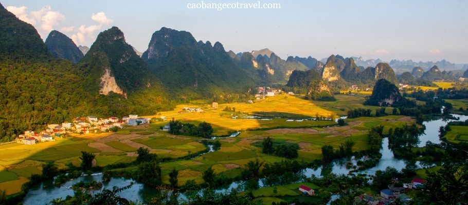
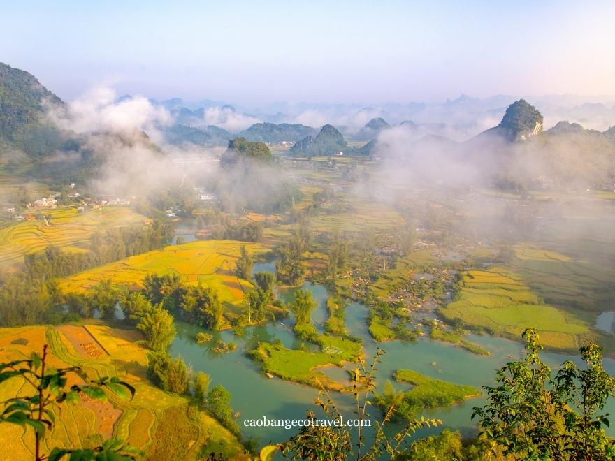
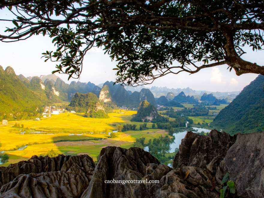
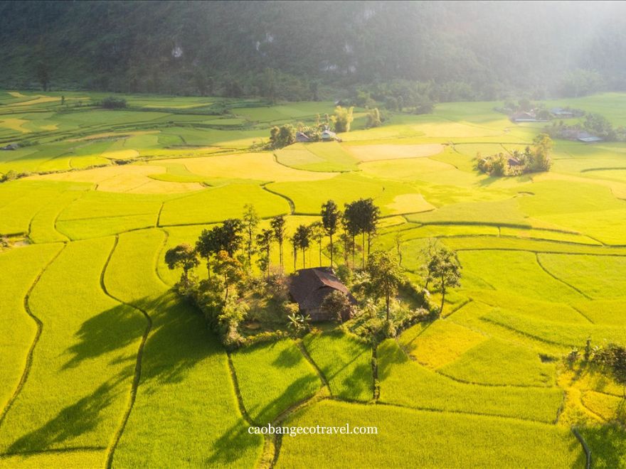
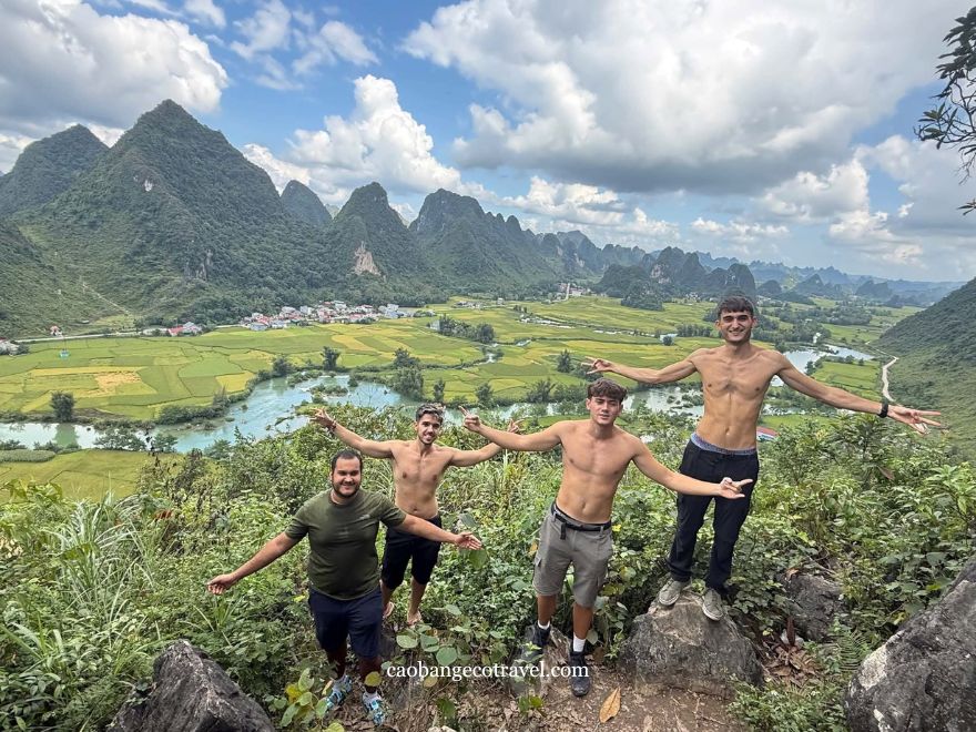
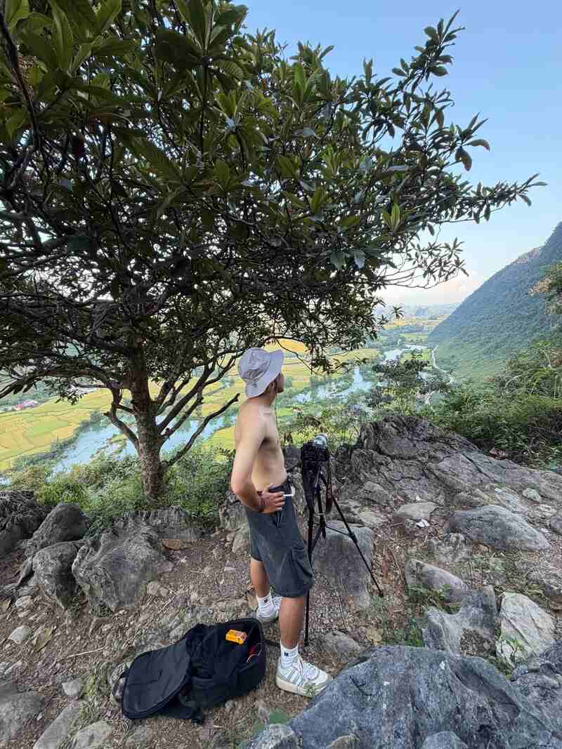
If one image defines Cao Bang's golden season, it is Phong Nam: the Quay Son curling through flat, golden paddies, limestone peaks on both sides and Tay and Nung houses scattered across the valley floor. The classic view is Phi Pha Viewpoint (22.9241, 106.5383), a 30 to 45 minute climb up the hill between Phong Nam and Ngoc Con.
Go at sunrise or late in the afternoon, when cloud often hangs halfway up the peaks and the low sun brings out every bend in the river. Some valley homestays also sit below their own lookout hills, with paths of 15 to 30 minutes; ask your host, and take a torch and shoes with grip, as the paths are slippery with dew before dawn. The valley is about 25 km Ban Gioc, and staying the night makes first light easy; our where to stay in Cao Bang guide lists the valley options with current prices.
Ngoc Con
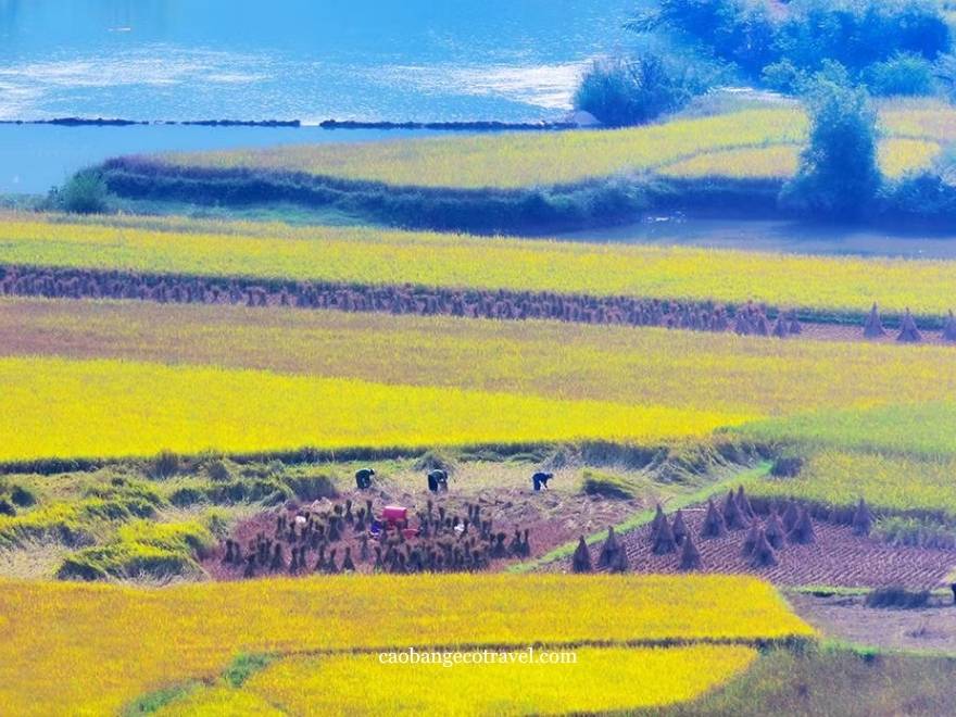
At the head of the valley, where the Quay Son flows in China, Ngoc Con grows nep ong (khau phjang in Tay), a local sticky rice planted in the riverside fields. Its harvest starts in late September. This is the place to watch the harvest itself, not only the colour. Nep ong is not swept with a sickle like ordinary paddy, 15 to 20 stems a stroke; Tay women pick it panicle by panicle and tie it small bundles, which some families dry on tarpaulins in the field they have just cleared. The road through Phong Nam carries on to Ngoc Con, so the two fit easily one morning. For the commune's waterfalls, caves and roads outside harvest time.
Hoai Khao and Lung Muoi: terraces in the west
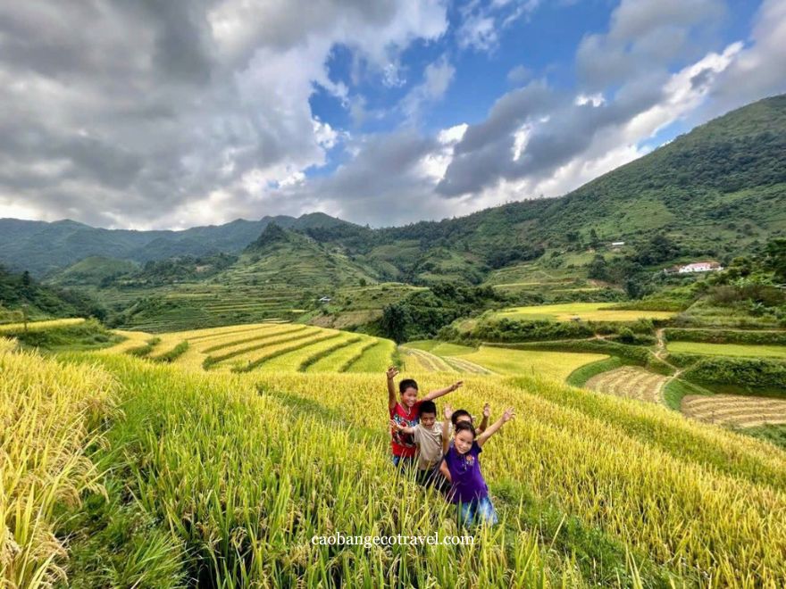
West of Cao Bang city, the landscape changes. The rice leaves the valley floors and climbs steep slopes in terraces around Dao Tien hamlets, and Hoai Khao and Lung Muoi, both now in Thanh Cong commune (formerly Quang Thanh), are the two places to see it. Our Nguyen Binh guide covers Dao Tien culture and the roads; below is what to know about the rice.
Hoai Khao
Hoai Khao is a Dao Tien community-tourism village in the Phja Oac and Phja Den area, with terraces running up the hillsides all around the hamlet. The slopes look their best in afternoon light, and at about 50 km Cao Bang city, the village is worth a night rather than a rushed return.
Lung Muoi
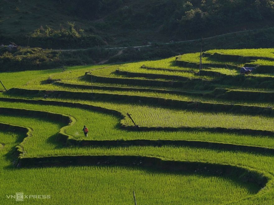
Lung Muoi sits in a stream valley about 45 km the city along a winding mountain road. Its terraces stack up both sides of the valley beneath Phja Oac, whose summit is often lost in cloud, so a clear afternoon is worth waiting for.
Further west: Bao Lac
Beyond Nguyen Binh, on the road towards Ha Giang, Bao Lac has terraces of its own around Xuan Truong and Hung Dao communes, the latter now including Khuoi Khon (formerly Kim Cuc commune). Lo Lo families farm the slopes around Khuoi Khon and San Chi families those around Hung Dao. It is too far for a day trip Cao Bang city, so it suits travellers riding between the Ha Giang and Cao Bang loops; our Bao Lac guide covers the route and where to stop.
Phia Thap: harvest beside an incense village
Closest to Cao Bang city, about 26 km along National Road 3, Phia Thap adds a colour of its own. Nung An families here make incense by hand and set the red bundles out to dry in the sun, with the ripening rice behind them, so this is the one stop where the harvest shares the frame with a craft.
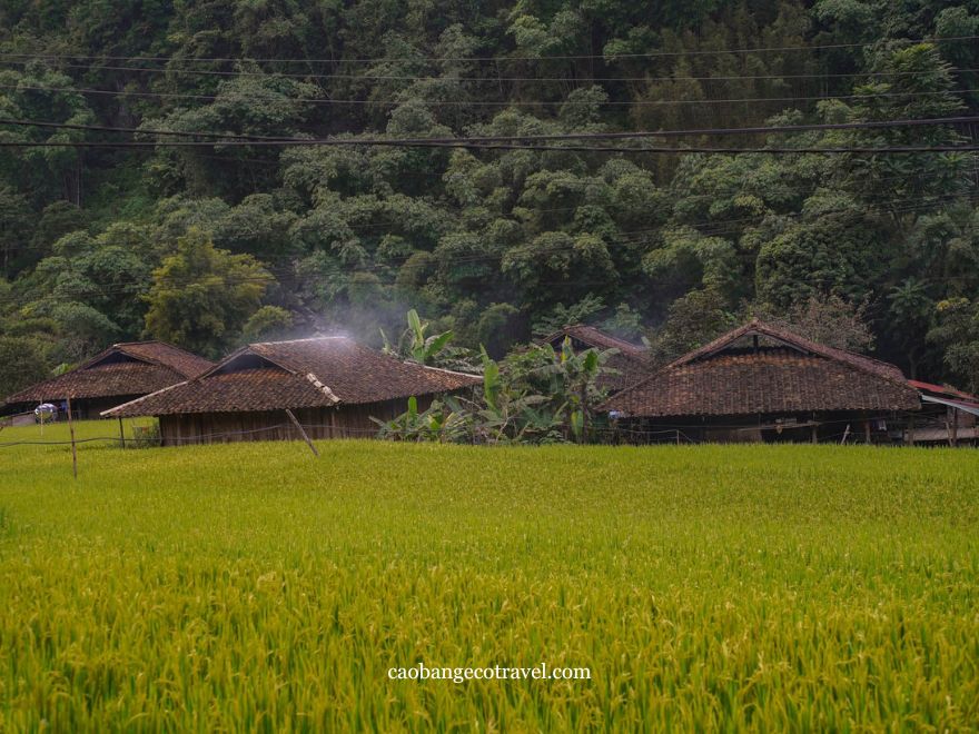
Phia Thap is one of Cao Bang's recognised traditional craft villages; if you would like to take incense or other handmade goods home, see our guide to local crafts and souvenirs. If you would like to try harvesting, have a host or guide ask a family first; the field and the crop are theirs. Because the village sits on the road east, most travellers stop here on the way to Ban Gioc.
How to plan a golden rice trip in Cao Bang
The five eastern spots make one long day Cao Bang city: Phia Thap on the way out, Ban Gioc and Thoong Got at the far end, then Phong Nam as a detour on the way back or, better for dawn light, an overnight. Give Nguyen Binh its own day, and keep one spare day in case rain dulls the light.
If you are coming for photographs, the usual rhythm is to reach a viewpoint before sunrise and head back out around 3pm for the afternoon light. A wide-angle lens takes in the valleys, a short telephoto lets you photograph people harvesting without walking their fields, and a small tripod helps in the low light at both ends of the day.
If you ride yourself, motorbike rental our Cao Bang city office costs 180,000 to 550,000 VND (about US$7 to US$21) a day, depending on the bike. Our Cao Bang Full-Day Tour follows much of the eastern route, with an incense village, Ban Gioc and Nguom Ngao Cave, then a return through the rice valleys between Trung Khanh and Tra Linh to Angel Eye Mountain for sunset. It costs 1,090,000 VND (about US$43) if you ride yourself or 1,490,000 VND (about US$58) with an easy rider, entrance tickets included (prices as of September 2026). Compare it with the longer trips on our Cao Bang Loop tours page, or work out your own budget with our Cao Bang Loop cost breakdown.
Good to know:
Every field is a family's year of work, so stay on the banks between paddies and ask before photographing anyone close up. Ban Gioc and Ngoc Con sit on the border, where drones are hard to fly, so plan for shots the ground and keep your passport with you. Dirt tracks along the rivers turn slippery after heavy rain; check with someone in the village before riding them, and see our list of what to prepare before the Cao Bang Loop for rain gear.
The golden season in Cao Bang is short and shifts by a few days each year, so keep your plans loose. A photo of the fields taken that same morning tells you more than any forecast; if you are unsure, message our team in Cao Bang city before you book.
FAQ
Is ''golden rice'' in Cao Bang a special rice variety?
No. The gold is the colour rice turns as it ripens, so any of Cao Bang's paddy fields can show it, including the nep ong sticky rice grown around Ngoc Con. It has no connection with Golden Rice, the genetically modified variety developed to produce beta-carotene.
Is Phong Nam Valley different the Trung Khanh rice fields?
Phong Nam is one part of them. ''Trung Khanh rice fields'' usually refers to the whole former Trung Khanh district, which also included Ngoc Con, Ngoc Khe and the fields around Ban Gioc. Since July 2025, Phong Nam, Ngoc Con and Ngoc Khe belong to Dinh Phong commune, Ban Gioc and Thoong Got to Dam Thuy, and Trung Khanh is now the name of the commune around the old district town.

Have 0 comments, reviews about 7 Places to Catch the Golden Rice Season in Cao Bang
Hello. Please leave a comment, we will respond soon.